USGS
We monitor, assess, map, and conduct targeted scientific research so that policymakers and the public have the understanding ...
@usgs subscribers
![[V3cam] Kīlauea volcano, Hawaii (south Halemaʻumaʻu crater)](/vi/BqmpkUdMtyA/mqdefault.jpg)
USGS
[V3cam] Kīlauea volcano, Hawaii (south Halemaʻumaʻu crater)
-

Discoverable
USGS Issue RED ALERT After Yellowstone’s Magma Changes Direction
2 days ago - 20:57
![[V2cam] Kīlauea volcano, Hawaii (east Halemaʻumaʻu crater)](/vi/fiyttmA7YkA/mqdefault.jpg)
USGS
[V2cam] Kīlauea volcano, Hawaii (east Halemaʻumaʻu crater)
-

Spatial Zone
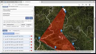
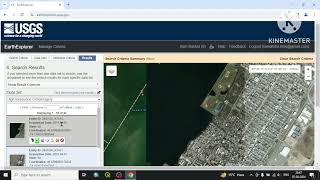
How To Download Landsat Imagery From USGS Earth Explorer For Free
2 years ago - 4:52

Discover Tube
USGS Issued RED ALERT After What They Just FOUND In Canada
3 days ago - 25:17

HVERI
USGS Lands Helicopter Near Kilauea's Eruptive Vent
1 month ago - 0:28

USGS
Time-lapse images of Mount St. Helens dome growth 2004-2008
12 years ago - 1:27

USGS
Massive Iceberg on the Loose (Image of the Week)
5 months ago - 2:26

USGS
Kīlauea Collapse and Refilling – Changes Since 2018
1 year ago - 1:42

afarTV
🔴 Live Now: 24/7 Kilauea Volcano Livestream in Hawaii (Cam A)
-

USGS
May 18, 1980 Mount St. Helens Eruption: Stories from USGS Scientists
4 years ago - 45:20
USGS Presentations
The USGS regularly hosts webinars, meetings, and presentations across all fields of earth science research.
@USGSPresentations subscribers

USGS
Paleoecology and Ecosystem Restoration Science at the USGS Florence Bascom Geoscience Center
5 years ago - 1:07
Discoverable
USGS Issued RED ALERT After What They Just FOUND At The Rio Grande!
5 days ago - 21:54

GeoDelta Labs
Downloading Digital Elevation Data (SRTM) from USGS EarthExplorer
4 years ago - 8:02
USGS
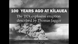
100 years ago at Kīlauea: The 1924 explosive eruption described by Thomas Jaggar
1 year ago - 2:24

USGS
USGS Ecosystem Research
4 years ago - 1:44

USGS
Karst Hazards Research at the USGS Florence Bascom Geoscience Center
5 years ago - 1:04

Earth Central
Strongest Earthquake of the Day (USGS): 5-16-20 Neiafu, Tonga
5 years ago - 0:27

Earth Science
Volcanic Eruption in Middle of Ocean #volcano #shorts #usgs #earthscience
1 month ago - 0:11

Discover Tube
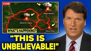
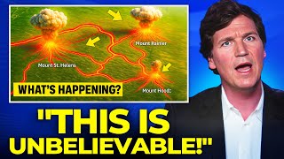
USGS Issues RED ALERT After Satellite Detects Magma Tunnels Connecting Rainier to St. Helens & Hood
11 days ago - 19:36

USGS
Biscuit Basin Hydrothermal Explosion Update (Yellowstone Monthly Update — October 2024)
9 months ago - 3:37

NEWS UPDATE
What If Yellowstone Erupted? Science Explainer #news
9 days ago - 2:01

KATU News
Hundreds of quakes rattle Mount Rainier-this USGS Cascades Volcano Observatory researcher shares why
2 weeks ago - 9:53

USGS
What I Love About My Job
4 years ago - 3:07
jgkix
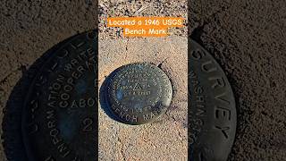
Located a 1946 USGS Bench Mark # found #located #USGS #mojavedesert #amazing #benchmark #jgkix
2 months ago - 0:37

WION
7.3-Magnitude Quake Strikes Off Alaska, Tsunami Warning Issued: USGS | WION Shorts
10 days ago - 0:22

Two Pineapples
KĪLAUEA IS ERUPTING | USGS Live Volcano Cam | Hawaiʻi 24/7
-
Discover Tube
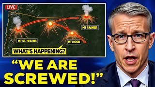
USGS ANNOUNCED ALERT After Satellite Detects Magma Tunnels Connecting Rainier to St. Helens & Hood
5 days ago - 21:00
USGS
The USGS Library
3 years ago - 5:14

USGS
Inside USGS No. 1, Robert Christiansen, Yellowstone
10 years ago - 37:19

USGS
1964 Quake: The Great Alaska Earthquake
11 years ago - 11:38

Blake Mead
USGS Research Facility Topping off Video
2 weeks ago - 3:56

USGS
Grand Prismatic Spring: Boiling, colorful & full of bacteria (Yellowstone Monthly Update, July 2025)
3 weeks ago - 4:43
Elite Vehicles
USGS Issue RED ALERT After Satellite Detects Magma Tunnels Connecting Rainier to St. Helens & Hood
13 days ago - 31:29

Eimy’s Hawaii Happy life 🏄🏻
Episode 28 Kīlauea Eruption USGS Helicopter #kilauea #hawaiivolcano #volcano #hawaiivolcanoeruption
2 weeks ago - 0:30

GIS Madras
Downloading Landsat 8 image from Earth Explorer - USGS
1 year ago - 12:41

Discoverable
USGS Issue RED ALERT After Cracks Discovered Beneath The Lake Mead!
5 days ago - 21:08

Mark Goldner
Using the USGS Earthquake site
7 months ago - 1:51

NBC News
USGS expert explains how geology of Northeast affects intensity of earthquakes
1 year ago - 3:05

WhiteTAILS Deer Hunting
Fishing Hunting Kayaking - Visit USGS Water Data Before You Go #USGS #fishing
1 year ago - 0:53

Quantum Quest
USGS Issues RED WARNING After Satellite Detects Magma Tunnels Connecting Rainier to St.Helens & Hood
9 days ago - 7:54
Discover Tube
USGS Issues RED ALERT After Satellite Detects Magma Tunnels Connecting Rainier to St. Helens & Hood
7 days ago - 18:41

RS & GIS
How to Download Free Digital Elevation Models (DEM) from USGS: A Step-by-Step Guide
2 years ago - 5:17

MGRS Grid
USGS 15x30 Quadrangle Map Explanation
2 months ago - 2:49
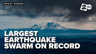
KATU News
'Most significant event' | USGS scientist discusses extraordinary earthquake swarm at Mount Rainier
2 weeks ago - 8:04
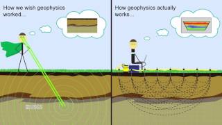
USGS
USGS Scenario Evaluator for Electrical Resistivity Survey Design Tool
8 years ago - 4:23

geomatika
DOWNLOAD : How to download dem data from usgs?
7 years ago - 1:27
USGS
Grand Prismatic Spring: Boiling, colorful & full of bacteria (Yellowstone Monthly Update, July 2025)
3 weeks ago - 4:43

Elite Vehicles
USGS Issue RED ALERT After What They Just Found Beneath The Colorado River Bed!
2 weeks ago - 31:17

Best Address
USGS Streamgage in Washington, DC #bestaddress #USGS #potomacriver #waterlevel #pollution
7 months ago - 0:54

USGS
Be Water Aware: USGS "Water-on-the-Go" Mobile Application
8 years ago - 0:55

SheerWill Survival
Free USGS maps for hunting/camping and why you need them
4 years ago - 11:25

Wake Up
Americans! Critical fact about Yellowstone🤯 #yellowstone #volcano #usgs #data #fact
2 years ago - 0:45
Study Adda
How to download High Resolution Imagery from USGS
1 year ago - 3:55

GeoShow
Flood Surge: See the Insane Rise in Minutes!
10 days ago - 1:29

Elite Vehicles
USGS Issue RED ALERT After Cracks Opened Beneath Texas Coast!
2 weeks ago - 30:30
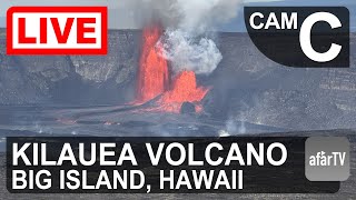
afarTV
🔴 Live Now: 24/7 Kilauea Volcano Livestream in Hawaii (Cam C)
-

Lance Page Films
USGS Scientists Heli Ops to Collect Lava Samples, New Kilauea Eruption Hawaii Volcanoes
2 years ago - 2:30
AZPM
Enter the USGS Southwest Repeat Photography Collection and Take a Journey Through Time
1 year ago - 5:49

High Desert Drew
QGIS Quick Tutorial (001) - Creating contour lines from USGS 3DEP Digital Elevation Models
4 years ago - 6:37

7StarTech
USGS Shakemap Earthquake Data + Polylines + ArcGIS - 3rd Map | P-3
7 months ago - 28:41

SCEC
Meet Dr. Max Schneider, a Research Statistician at the USGS!
2 years ago - 0:51

Red Pill Clips
Explore USGS LiDAR Data on Google Earth with Cintos!
4 weeks ago - 0:32