Matt Forrest
Learn GIS - QGIS Full Course for Beginners (New for 2024)
1 year ago - 1:12:46

Spatial Thoughts
Introduction to QGIS (Full Course, Ad-Free)
11 months ago - 4:35:32

QGIS
This channel is for sharing streams and recordings of community events. QGIS is a Free and Open Source Geographic Information ...
@qgishome subscribers

IT34
QGIS Beginner Part 1: Making Your First Map
2 years ago - 6:17

GeoDelta Labs
An Absolute Beginner's Guide to QGIS 3
5 years ago - 1:10:08

Maps by RGD
How to use QGIS and QField to collect data. Creating a Project #qgis #qfield
11 months ago - 0:20

Maps by RGD
How to use QGIS and QField to collect data. Creating a Project #qgis #qfield
11 months ago - 0:19

Felt
How to Georeference in QGIS (2024)
1 year ago - 8:19

GISWorld
Python coding in QGIS with ChatGPT !💪 #python #chatgpt #qgis #shorts
1 year ago - 0:16

Maps by RGD
How to use QGIS and QField to collect data. Creating a Project #qgis #qfield
11 months ago - 0:15

Map Hacks
QGIS - How to make a map of Australia
2 years ago - 0:32

Felt
How to make an isochrone in #QGIS in less than a minute! 💪🏻🚗🚶♂️🗺️
1 year ago - 0:13

RS & GIS
Top 5 Most Downloaded QGIS Plugins You Need in 2025!
1 month ago - 11:14

RS & GIS
QGIS Full Course for Beginners: Master GIS Mapping & Analysis for Free!
2 years ago - 53:40

GeoDelta Labs
Importing CSV (Excel) Coordinates into QGIS
5 years ago - 6:01
Felt
#QGIS Quick Tip #2 - The Identify Feature Tool
1 year ago - 0:26

GISWorld
Simplest way to convert AutoCAD file to GIS 😉😉💪! #qgis #opensource#autocad #shorts
1 year ago - 0:16
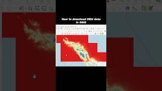
iamacat
How to download DEM data in QGIS #dem #qgis #gis #remotesensing
8 months ago - 0:27

GeoBhoomi
How to Download QGIS in 2024 #geospatialtechnology #qgis
10 months ago - 0:23

GIS Educator
QGIS for Absolute Beginners 2025 | Complete Step by Step GIS Tutorial
2 months ago - 1:27:35

THE SMART GIS TECH
How to Rotate Labels in QGIS | Label Rotate in QGIS #shorts #gis #qgis #knowledge
2 years ago - 0:20

Made Python
How to Make an ESRI Shape File using Google Earth and QGIS #shorts #tutorial #QGIS #googleearth
2 years ago - 0:23

IonBotics
Create a Polygon in QGIS - GIS Tutorial
3 years ago - 3:25

Made Python
How to Download QGIS #shorts #tutorial #qgis
2 years ago - 0:14

GIS Expert
QGIS 3.22 Beginner’s Guide - Complete Tutorial - How to Make a MAP from ZERO
3 years ago - 54:22

Madhuraj PK
Creating Shapefile and Study Area Map for any Location | Latest Tutorial using QGIS
1 year ago - 26:28

Ahmed Kullab
#shorts QGIS Automation using ChatGPT and Graphical Modeler
2 years ago - 0:40
QGIS for Ecologists
@QGISforEcologists subscribers

Dr. Festus
Create study area map using QGIS: Detailed step by step methods
3 years ago - 1:53:40

GeoDelta Labs
Landsat 8 Image Classification using QGIS
4 years ago - 32:01

GeoDelta Labs
Complete QGIS Watershed Delineation Tutorial
10 months ago - 1:08:48

Felt
11 QGIS Tips for Newbies🤯🗺️
1 year ago - 7:31

The_geographer_man
Digitization of polygon in Qgis vectorization in QGIS// how #digitalize a map, point, #geography
10 months ago - 0:16

GisClever
Line Shapes - important GIS features! #gis #geography #mapping #qgis #arcgis #cartography
1 year ago - 0:24

The NDS Show
ARCGIS versus QGIS: Geospatial Uses #arcgis #datascience #earthscience #geography
2 years ago - 0:39
QGIS WORLD
QGIS WORLD delivers content that helps in several spatial analysis processes with the video ranging from beginner to pro level.
@qgisworld1922 subscribers

GeoBhoomi
Open csv file in Qgis #geospatialtechnology #qgis #opensource #education
10 months ago - 0:43

TheContour
QGIS Part4 - How to create your first map in 15 mins
5 years ago - 14:56

QGIS
Teaching Projections in Classroom with QGIS - workshop
Streamed 1 day ago - 1:05:58
Bunting Labs
The fastest way to find Shapefiles in QGIS: /find #qgis #gis #gissoftware the Kue plugin for QGIS
7 months ago - 0:28

Self Study Tutorials
Getting Started With QGIS Project | How to Create a New QGIS Project
3 years ago - 5:57

Mana Surveyor
Remove Errors in Polygon #qgis #manasurveyor
1 year ago - 0:29

Geodemia
How to add shp file into Qgis from any zip file #geography #qgis #shorts #qgistutorial
2 years ago - 1:00

The_geographer_man
digitization using the line feature in QGIS#geography #gis #qgis #arcgistutorial #raster #vector
9 months ago - 0:16

Hans van der Kwast
Download DEMs in QGIS for a Specified Extent with the OpenTopography DEM Downloader Plugin
3 years ago - 4:00

GeoDelta Labs
Developing a 3D Model using QGIS
5 years ago - 13:19

Antonio Locandro
QGIS stream digitizing with a Huion Pen/Tablet combo #shorts
2 years ago - 0:30

Spatial Thoughts
QGIS Expressions Masterclass (Full Workshop, Ad-Free)
1 month ago - 1:17:35

GIS in Telugu
Attribute transfer in #qgis by #gisintelugu #qgisintelugu
10 months ago - 0:16

QGIS
Teaching Projections in Classroom with QGIS - introduction (theory)
Streamed 1 day ago - 40:26

AgriMetSoft Team
QGIS Create Shapefile || Shapefile Layer in QGIS
4 years ago - 5:52

GeoDelta Labs
Making a Geological Map using QGIS
4 years ago - 35:13

Spatialize
ArcGIS VS QGIS -which one is suitable for you? #qgis #arcgis
10 months ago - 1:00
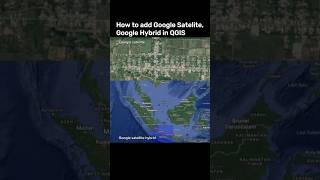
iamacat
How to add Google Satellite & Google Hybrid in QGIS | URL in Description down below #shorts
8 months ago - 0:35

Bunting Labs
Selecting features in QGIS using AI
8 months ago - 0:45
The_geographer_man
digitization using the line feature in QGIS#geography #gis #qgis #arcgistutorial #raster #vector
9 months ago - 0:16

Qgizada
Criando Polígono shapefile no Qgis #qgis3 #qgistutorials #qgistutorial #qgis #geoprocessamento
1 month ago - 0:11

Map Hacks
QGIS - 3 steps to make your Topography Pop!
2 years ago - 0:35

Bunting Labs
Using AI to do geoprocessing in QGIS #gis #qgis
8 months ago - 0:49
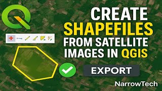
NarrowTech
Create Shapefiles from Satellite Imagery in QGIS | Beginner-Friendly GIS Tutorial Creating shapefile
6 days ago - 6:59

GISWorld
How to use Deepseek AI for map creation in QGIS.
5 months ago - 0:30

Map Academy
Labelling roads, neatly, in QGIS
2 years ago - 5:34

RS & GIS
Creating a web map using qgis2web Plugin in QGIS
1 year ago - 12:02
Klas Karlsson
My channel is about a lot of things that interest me. A dominant subject is GIS and Open Source. Some of it is in English, some in ...
@KlasKarlsson subscribers

Bunting Labs
Adding new layers in QGIS with Kue #gis #qgis #ai
7 months ago - 0:44

Bunting Labs
QGIS: adding attributes to vector layers with AI (Kue QGIS plugin) #gis #qgis #ai
7 months ago - 0:49

Get Skilled
Fastest way to add google maps in QGIS and other QUICK MAP SERVICES
2 years ago - 5:54
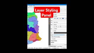
tekki GEO
Layer Styling in QGIS: Mastering the Layer Styling Panel #qgis
1 year ago - 0:59

GISWorld
Automating Area Updates in QGIS: Simplify Your Workflow with Geometry Changes. #shorts #qgis
1 year ago - 0:53

RS & GIS
6 Practical QGIS Plugins (Top plugins you should use in QGIS)
1 year ago - 5:13

Engineering Zone
ArcGIS ArcMap QGIS GIS Mapping Pakistan Map Spatial Analysis Flood Mapping
2 months ago - 0:08

Klas Karlsson
QGIS - for Absolute Beginners (Old! New video is released! Link in description)
9 years ago - 30:18

Philip White
Extracting Data from OpenStreetMap using QGIS & QuickOSM
5 years ago - 7:22

Terra Spatial
QGIS Tutorials 35: How to use Clip tool in QGIS | Beginners | QGIS 3.22 | Vector Clipping
2 years ago - 4:19

QGIS
QGIS Documentation and Websites updates from May 05 – May 16, 2025
2 months ago - 4:36
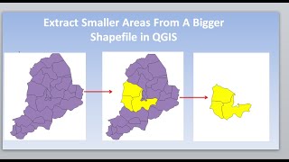
Geojay GIS Solution
How To Extract Smaller Areas From A Bigger Shapefile in QGIS
9 months ago - 2:22

UMFK Forestry
Exporting attribute table to Excel spreadsheet in QGIS 3.16
4 years ago - 0:32

NickB
How fast can you make a cross section in QGIS?
4 years ago - 0:38
QGIS North America
Videos from the QGIS North America virtual conference.
@qgisnorthamerica1479 subscribers

Bunting Labs
How to georeference aerial/drone imagery in QGIS using AI (October 2024)
9 months ago - 2:29

Terra Spatial
QGIS Tutorials 43: Merge or Mosaic Raster image in QGIS | Merge Tool
2 years ago - 3:30

River Geeks
Calculating Curve Number in QGIS - Simplified! #curvenumber #qgis #hydrology
1 year ago - 7:47

Nicko16
Create Accurate Maps with Blender GIS and QGIS
1 year ago - 18:57

GeoDelta Labs
How to Visualize Buildings in 3D in QGIS
3 days ago - 10:13

DreamGIS
How to join excel data sheet with QGIS attribute table
1 year ago - 4:38

GIS Solutions
QFIELD Mobile Solution for Field Data Collection | QGIS Plugin
7 months ago - 22:15