USGS
We monitor, assess, map, and conduct targeted scientific research so that policymakers and the public have the understanding ...
@usgs subscribers
![[V3cam] Kīlauea volcano, Hawaii (south Halemaʻumaʻu crater)](/vi/BqmpkUdMtyA/mqdefault.jpg)
USGS
[V3cam] Kīlauea volcano, Hawaii (south Halemaʻumaʻu crater)
-

WorldCam
🌎 LIVE: Real-Time Global Earthquake Tracker 🌍 NEW! Russia 8.8M
-

GlobalQuake
Aftershocks in Kamchatka continue | Live Earthquake Monitoring | GlobalQuake
-
![[V2cam] Kīlauea volcano, Hawaii (east Halemaʻumaʻu crater)](/vi/fiyttmA7YkA/mqdefault.jpg)
USGS
[V2cam] Kīlauea volcano, Hawaii (east Halemaʻumaʻu crater)
-

Discoverable
USGS Issue RED ALERT After Satellite Detects Magma Tunnels Connecting Mount Meager to US Volcanoes!
1 day ago - 21:35

Spatial Zone
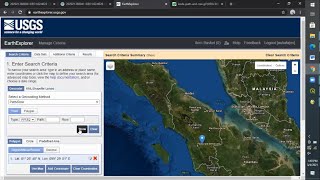
How To Download Landsat Imagery From USGS Earth Explorer For Free
2 years ago - 4:52
USGS Presentations
The USGS regularly hosts webinars, meetings, and presentations across all fields of earth science research.
@USGSPresentations subscribers

USGS
Time-lapse images of Mount St. Helens dome growth 2004-2008
12 years ago - 1:27

USGS
1964 Quake: The Great Alaska Earthquake
11 years ago - 11:38

Suzie (OzarksNative)
Save USGS Environmental Services #USGS #Flooding #meramacsprings #Montauk #Rivers #Missouri #Trout
1 month ago - 1:38

Discoverable
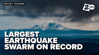
USGS Issue Red Alert After Mysterious Earthquake Surge at Mount Rainier
5 days ago - 21:29

Two Pineapples
KĪLAUEA IS ERUPTING | USGS Live Volcano Cam | Hawaiʻi 24/7
-

USGS
Massive Iceberg on the Loose (Image of the Week)
5 months ago - 2:26

Earth Central
Strongest Earthquake of the Day (USGS): 5-16-20 Neiafu, Tonga
5 years ago - 0:27

TheEarthMaster
USGS States 8.8 only Partially Released built up strain. Latest update on MegaQuake Wednesday Night
3 days ago - 31:59

USGS
USGS Ecosystem Research
4 years ago - 1:44

USGS
A Year Since the Biscuit Basin Hydrothermal Explosion (Yellowstone Monthly Update - August 2025)
1 day ago - 5:18
![[V1cam] Kīlauea volcano, Hawaii (west Halemaʻumaʻu crater)](/vi/sTXKIz2NGvg/mqdefault.jpg)
USGS
[V1cam] Kīlauea volcano, Hawaii (west Halemaʻumaʻu crater)
-

afarTV
🔴 Live Now: 24/7 Kilauea Volcano Livestream in Hawaii (Cam A)
-

GeoDelta Labs
Downloading Digital Elevation Data (SRTM) from USGS EarthExplorer
4 years ago - 8:02

USGS
USGS Streamgaging - Keeping the pulse on the Nation’s streams
6 years ago - 1:02
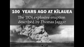
USGS
100 years ago at Kīlauea: The 1924 explosive eruption described by Thomas Jaggar
1 year ago - 2:24

USGS
Biscuit Basin Hydrothermal Explosion Update (Yellowstone Monthly Update — October 2024)
10 months ago - 3:37
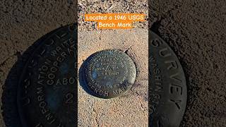
jgkix
Located a 1946 USGS Bench Mark # found #located #USGS #mojavedesert #amazing #benchmark #jgkix
2 months ago - 0:37

USGS
USGS Status Update of Kīlauea Volcano - May 22, 2018
7 years ago - 0:53

WhiteTAILS Deer Hunting
Fishing Hunting Kayaking - Visit USGS Water Data Before You Go #USGS #fishing
1 year ago - 0:53
USGS
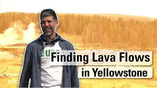
Finding Lava Flows in Yellowstone (Yellowstone Monthly Update - May 2025)
2 months ago - 3:14

USGS
What I Love About My Job
4 years ago - 3:07

The Ultimate Discovery
USGS: A Leak Has Been Found In The Floor Of The Ocean Near Mount St. Helens And It's Terrifying
6 months ago - 22:41

Red Pill Clips
Explore USGS LiDAR Data on Google Earth with Cintos!
1 month ago - 0:32

KATU News
Hundreds of quakes rattle Mount Rainier-this USGS Cascades Volcano Observatory researcher shares why
3 weeks ago - 9:53

NEWS UPDATE
What If Yellowstone Erupted? Science Explainer #news
2 weeks ago - 2:01

MGRS Grid
USGS 15x30 Quadrangle Map Explanation
3 months ago - 2:49
Warren Rosenthal
How to use USGS gauge data for water levels & CFS
3 years ago - 3:22

USGS
World Ocean Day
1 month ago - 0:44
Elite Vehicles
USGS Issue RED ALERT After Satellite Detects Magma Tunnels Connecting Rainier to St. Helens & Hood
2 weeks ago - 31:29

Elite Vehicles
USGS Issue RED ALERT After Cracks Opened Beneath Texas Coast!
3 weeks ago - 30:30

geomatika
DOWNLOAD : How to download dem data from usgs?
7 years ago - 1:27

Chasing Big Fish
How To Find Property Boundaries On USGS Maps? - Chasing Big Fish
1 month ago - 3:43

NBC News
USGS expert explains how geology of Northeast affects intensity of earthquakes
1 year ago - 3:05

Best Address
USGS Streamgage in Washington, DC #bestaddress #USGS #potomacriver #waterlevel #pollution
7 months ago - 0:54

Blake Mead
USGS Research Facility Topping off Video
3 weeks ago - 3:56

USGS
USGS Gas Hydrates Lab
13 years ago - 6:45

A man who ...
How to Download DEM files | USGS Earth Explorer
2 years ago - 3:18

ABC7
4.4 magnitude earthquake hits Inland Empire
Streamed 2 days ago - 21:29

USGS
Inside USGS No. 1, Robert Christiansen, Yellowstone
10 years ago - 37:19

Geo Week
USGS 3DEP Plenary
4 months ago - 56:49

Mark Goldner
Using the USGS Earthquake site
7 months ago - 1:51

WION
7.3-Magnitude Quake Strikes Off Alaska, Tsunami Warning Issued: USGS | WION Shorts
2 weeks ago - 0:22

ABC7 News Bay Area
5.2 magnitude earthquake strikes near San Diego, USGS says
3 months ago - 0:15

USGS
Be Water Aware: USGS "Water-on-the-Go" Mobile Application
8 years ago - 0:55
MGRS Grid
USGS 15x30 Quadrangle Map Explanation
3 months ago - 2:49
USA ARMED
Yellowstone: USGS Issue Dire Warning After 1000 Magnitude quake Detec Under Yellowstone
9 days ago - 8:52

Dawn Of Geospatial World
Download Landsat Images in 1 min #shorts #landsat #download #satelliteimagery
2 years ago - 0:59

USGS
USGS Alaska Science Center Shorebird Research Program
2 years ago - 2:43

NBCLA
New USGS maps show likelihood of big quakes in California and U.S.
1 year ago - 2:52

USGS
4 Ways Wildfires Change Landscapes
2 months ago - 0:57

USGS
Mauna Loa Eruption, HI - USGS live stream
Streamed 2 years ago - 39:53

Survival world
Today earthquake #earthquakeSan jose#Californiaearthquake#usgs earthquake#earthquakebay area#cricket
10 months ago - 0:26

High Desert Drew
QGIS Quick Tutorial (001) - Creating contour lines from USGS 3DEP Digital Elevation Models
4 years ago - 6:37
KATU News
'Most significant event' | USGS scientist discusses extraordinary earthquake swarm at Mount Rainier
3 weeks ago - 8:04

Discoverable
USGS Issue Red Alert After Satellite Reveals Massive Rift Beneath the Missouri River
3 weeks ago - 22:24
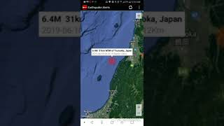
Earth Central
Strongest Earthquake of the Day: June 18th, 2019 Tsuruoka, Japan (USGS Edition)
6 years ago - 0:34

Lance Page Films
USGS Scientists Heli Ops to Collect Lava Samples, New Kilauea Eruption Hawaii Volcanoes
2 years ago - 2:30

Beyond Discovery
USGS: Reports Increased Earthquake Activity in Cascade Range Volcanoes
7 months ago - 28:34

ExpertGPS
How to Explore Your Area's Past with Historical USGS Topo Maps
7 years ago - 2:42

Elite Vehicles
USGS Issue RED ALERT After What They Just Found Beneath The Colorado River Bed!
3 weeks ago - 31:17

HVERI
USGS Lands Helicopter Near Kilauea's Eruptive Vent
1 month ago - 0:28
Discoverable
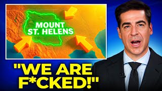
USGS Issue RED ALERT After Mount St. Helens' Magma Changes Direction
3 days ago - 20:25
USGS Trainings
The USGS provides training and tutorials on various USGS products and services, how to use our data, and much more.
@USGSTrainings subscribers

Discover Tube
USGS Issues RED ALERT After Satellite Detects Magma Tunnels Connecting Rainier to St. Helens & Hood
2 weeks ago - 19:36

Davina's Wonderland
Unveiling the Mysteries of Volcanoes with USGS Volcano Science! 🌋
1 year ago - 3:08

Straight Path
How to download multiple DEMs from USGS for Entire Area in ArcGIS
4 years ago - 7:05

HydroMohsen
Download and Visualize Daily Streamflow Data from USGS Using Python
3 years ago - 15:57

UG Solutions
How to download Landsat 9 images from USGS
1 year ago - 8:12

IXRF, Inc.
US Geological Survey Customer Spotlight
1 year ago - 0:46
Aulia Fajrin R. Nasution
How to Download Spatial Data from USGS Earth Explorer (Raster) and Ina-Geoportal (Vector)
4 years ago - 8:09

Sam Hendricks
Open weather and earthquake.usgs.gov API Example
1 year ago - 5:03

NewsNation
Mount St. Helens ‘recharging’ after USGS records earthquake increase in 2024 | NewsNation Now
1 year ago - 5:07

Earth and Space Sciences X
Geological First Impressions of the Magnitude 8.8 Kamchatka Earthquake and Tsunami (July 29, 2025)
4 days ago - 15:04

USGS
USGS Hammond Bay Biological Station Renovation Time Lapse
8 years ago - 4:00

Earth Science
Volcanic Eruption in Middle of Ocean #volcano #shorts #usgs #earthscience
2 months ago - 0:11

Gowtham Singh
Usgs earth exlporer sign in procedure
8 days ago - 0:27

amitchellnc
USGS Earthquake Map tool
5 years ago - 1:44

FlopDudeGaming
How to find and use USGS's lithological map of the US
2 years ago - 2:35

Dane Dupont
USGS Geophysicist Jefferson Chang talks about technologies that track activity at Hawaiian volcanoes
4 years ago - 18:58

Two Pineapples
Kīlauea’s Next Eruption? USGS Forecast is In!
1 month ago - 0:19
Dawn Of Geospatial World
Download Landsat Images in 1 min #shorts #landsat #download #satelliteimagery
2 years ago - 0:59

Berama Academy
Download Digital Elevation Data DEM SRTM from USGS Earth Explorer
5 months ago - 0:50
USGS Trainings
The USGS provides training and tutorials on various USGS products and services, how to use our data, and much more.
@USGSTrainings subscribers