GeoDelta Labs
A Complete Beginner's Guide to ArcGIS Desktop (Part 1)
4 years ago - 1:00:57

ArcGIS Mastery
ArcMap 10.8 Basics for beginners | ArcGIS Mastery
5 years ago - 21:00

ArcGIS
Our ArcGIS videos provide insight into Esri GIS software, with demos, technical sessions, case studies & more. Find out how you ...
@esri_arcgis subscribers

GIS Madras
Tutorial 1: ArcGIS Basic Tools for Beginners - Introduction
5 years ago - 9:49
NarrowTech
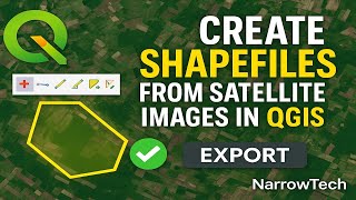
Create Shapefiles from Satellite Imagery in QGIS | Beginner-Friendly GIS Tutorial Creating shapefile
1 day ago - 6:59

GIS Studio
How to split a polyline in ArcMap
6 years ago - 0:22

All Things Maps
Quick & Easy ArcMap to ArcGIS Pro: First Steps to Learn the Basics
3 years ago - 13:21

ArcGIS
Make a layout in ArcGIS Pro
2 years ago - 8:38

GeoDelta Labs
Importing Excel Coordinates to ArcMap and Plotting
6 years ago - 4:30

Terra Spatial
How to create shapefile in ArcGIS#shorts
2 years ago - 0:35

GIS & RS tutorials
ArcGis Tutorial for the beginner part 1/ Add DEM Image
2 years ago - 0:27
ArcGIS Mastery
ArcGIS Mastery online course has been designed by a professional covering all Esri products chronically in one place with ...
@arcgismastery4750 subscribers

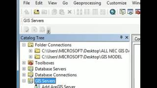
GeoDelta Labs
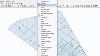
Advanced Geoprocessing Applications using ArcGIS - Part 1
4 years ago - 42:00

GIS & RS Solution
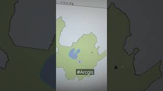
Study Area Mapping | Create Map Layout in ArcGIS
5 years ago - 17:14

NAMONET.
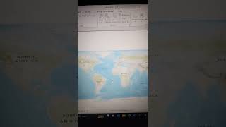
ArcGIS | Creating map on ArcGIS Amharic tutorial|nastech|Title|Date| Grid| Scale|Author |NAMONET.
2 years ago - 20:53

Spatial Monkey
How to edit in ArcGIS Pro and ArcMap
3 years ago - 18:50

famedancer713
Spatial Analysis in ArcGIS Pro #SpatialAnalysis #ArcGISPRO #DataAnalytics #Geospatial #DataScience
2 years ago - 0:16

GeoDelta Labs
A Complete Beginner's Guide to ArcGIS Desktop (Part 3)
4 years ago - 49:44

ArcGIS Mastery
ArcGIS Pro Basics for beginners | ArcGIS Mastery
3 years ago - 57:06

burdGIS
Arcmap to ArcGIS pro 04 - importing an mxd | burdGIS
6 years ago - 5:11

ArcGIS
Introducing ArcGIS Pro
8 months ago - 13:21
UTMLibrary
A Basic Introduction to ArcMap 10
14 years ago - 2:20

ProGIS
Copying and pasting features ArcMap
5 years ago - 0:29

GeoDelta Labs
A Complete Beginner's Guide to ArcGIS Desktop (Part 2)
4 years ago - 44:10

Civil Engineering
How To Make Study Area Map in ArcGIS. Complete Process. #arcgis #studyareamap #civilengineering
3 years ago - 14:56

eGIS Associates
ArcMap vs ArcGIS Pro - Comparing these two GIS applications from Esri
6 years ago - 34:47

AP Technology
how to create shapfile in ArcGIS desktop
1 year ago - 0:16

Shahriar GIS School
ArcMap vs ArcGIS Pro (Course: ArcGIS vs ArcGIS Pro Level 1: Fundamental, Lecture:12) | Desktop GIS |
4 years ago - 3:45

Esri Canada
Migrating from ArcMap to ArcGIS Pro
4 years ago - 8:23

GeoDelta Labs
Digitizing in ArcMap (and Adding Labels to the Features)
6 years ago - 14:07

Geonity
Prepare soil map ArcGIS ArcMap. Map layout GIS #map #tutorial #gis #arcmap #education #topography
6 months ago - 0:16

Spatial Zone
What Is GIS? A Guide to Geographic Information Systems
2 years ago - 8:03

GISmentor 2020
Three Ways in Georeferencing JPEG Map Images in ArcMap/ArcGIS
4 years ago - 15:24

Mr Cognito
Vector vs Raster Data - GIS Explained
1 year ago - 2:35

Terra Spatial
Interpolation: Kriging using ArcGIS
5 years ago - 4:16

Ram Khilawan
Selected Feature Count in ArcGIS #FeatureCount #GISAnalysis #ArcGISTips #sorts #viral #trending
13 days ago - 0:19

Don Boyes
Vector buffers in ArcMap
12 years ago - 5:23

RS & GIS
ArcGIS Pro Complete Beginner's Tutorial - ArcGIS Pro Full Course
3 years ago - 1:19:19
El Geógrafo
Clip #arcmap #arcgistutorial
2 years ago - 0:13
Arnold Kilaini
How to connect Living Atlas in ArcGIS Pro.#data #arcgispro #gis #arnold #mutegeki #kilaini #mapping
1 year ago - 0:59

ArcGIS
Get Started with ArcGIS Online
3 years ago - 3:09

Chris Goranson
GIS Tutorial: How to perform a spatial join in ArcMap
14 years ago - 6:06

GIS Artisan
Import an ArcMap .MXD file into ArcGIS Pro in just ONE minute!
2 years ago - 1:01

GeoDelta Labs
How to Georeference an Image or a Scanned Map using ArcMap
6 years ago - 17:09

Esri
Generative AI Prototypes in ArcGIS
8 months ago - 3:36

Spatial Zone
Converting Labels to Annotations or Graphics in ArcGIS Pro
1 year ago - 2:27

Maven Design
How to Export attribute table from ArcGIS to Excel sheet l The Easiest export
5 years ago - 2:01

i12share
Add XY Coordinates in ArcGIS
4 years ago - 2:03
![How to create a point In ArcGIS [Insert X,Y coordinates]](/vi/S4sG1n71bas/mqdefault.jpg)
ENG-School
How to create a point In ArcGIS [Insert X,Y coordinates]
2 years ago - 2:38

Don Boyes
Basic Topology in ArcMap
12 years ago - 6:03

burdGIS
Arcmap to ArcGIS Pro 01 - Installing ArcPro trial | burdGIS
7 years ago - 6:08

GIS Chops
ArcGIS Pro Editing - Start and Stop an Edit Session
3 years ago - 1:48

ArcGIS
Easily Create a Spatial Map Series in ArcGIS Pro
2 years ago - 7:38

Plano Area
Perbedaan antara Union, Intersect, dan Merge di ArcGIS
5 months ago - 0:58

ProGIS
Remove decimal places from coordinates in grid ArcMap
4 years ago - 0:42

Archi Team
ArcGIS# How to export GIS map to AutoCAD
3 years ago - 1:46

Steve Aldrich
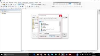
ArcGIS Pro - Connect to a Folder and Add Data
4 years ago - 3:49

Esri
3 New Cartography Features in ArcGIS Pro
1 year ago - 2:12
The oBby
Adding basemap in the ArcMap, ArcGis
8 years ago - 3:00

ENG-School
Change Projection Coordinate System in ArcMap | Change Coordinate System GIS
3 years ago - 2:40

GeolóGIS
🗺️ Extrae Datos RASTER con Máscara SHAPEFILE en ArcMap 10.8 🌍 #ArcMap #Geoprocesamiento #SIG #arcgis
1 year ago - 0:16

GeoMicrosphere
Introduction to ArcGIS Pro for Beginners | Learn GIS Step-by-Step
4 days ago - 23:53
Terra Spatial
Interpolation: Kriging using ArcGIS
5 years ago - 4:16

GIS Klaster
Menambahkan nilai koordinat di attribut table #gis #arcmap
2 years ago - 0:45

Steve Aldrich
ArcGIS Pro - Pan and Zoom in Map and Layout Views
4 years ago - 2:18

Spatial Monkey
How to create an ArcGIS Pro Python Toolbox with example code
1 year ago - 5:44
GeoMindz.com
"Geographic Coordinate Systems" and "Projected Coordinate Systems" in ArcGIS and ArcMap
7 years ago - 8:57

Programology
How to make shapefile in arcgis, creating a shapefile in arcmap, arcgis tutorial for beginners
8 years ago - 3:36

Dan GIS Spatial Lab
How to Mosaic or Merge Satellite images in ArcGIS or ArcMap
3 years ago - 6:44

Made 4 Geek
Arcgis : Merge the raster datasets /fusionner raster arcgis /Mosaic raster dataset ArcGIS
9 years ago - 5:10

RS & GIS
How to add the latest Google Earth images to ArcGIS directly
1 year ago - 3:43

Civil Tycoon
how to import excel data into arcgis quickly
5 years ago - 1:43

GIS & RS Solution
A Complete Beginner's Guide to ArcGIS Pro: Part 1
3 years ago - 9:39

Mahasiswa STPN
Cara Mudah Georeference di ArcMap - Tutorial Cepat & Praktis! #gismapping #fypyoutube #fyp #arcgis
6 months ago - 0:18

ArcGIS
Georeferencing in ArcGIS Pro in 5 Minutes: Rubbersheeting
3 years ago - 6:12

ArcGIS
ArcGIS Survey123: Product Overview
4 years ago - 3:30

Obaidur Rahman
Master the Digitizing in 15 Minutes | ArcGIS In-Depth Tutorial
5 years ago - 16:23

ArcGIS
Navigate maps and scenes in ArcGIS Pro
2 years ago - 7:44

ArcGIS
Get to Know ArcGIS Field Maps
4 years ago - 3:26

Ahsan Khan
Exporting from Arc GIS to Google Earth Pro
3 years ago - 1:36

Dr. Jayanta Das
How to add PDF files and do georeferencing in ArcMap?
4 years ago - 6:49

Karl Olsen
ArcGIS 10 - ArcMap - Saving Data
14 years ago - 1:19

Terra Spatial
Select by Location in ArcMap - ArcGIS for Beginners
2 years ago - 4:15
burdGIS
Arcmap to ArcGIS pro 04 - importing an mxd | burdGIS
6 years ago - 5:11

Steve Aldrich
ArcGIS Pro - Adding a Field to an Attribute Table
4 years ago - 3:05

ArcGIS
ArcGIS Online: Mapping Basics
3 years ago - 3:32

GIS news
create topology in ArcGIS
8 years ago - 2:51

Geo Magazine
ArcMap Convert Polylines to Polygons, Two easy methods
6 years ago - 3:34

ArcGIS
What's New in ArcGIS Enterprise 11.5
1 month ago - 4:04

gis2cad
convert shapefile to geodatabase in ArcGIS
8 years ago - 2:10

Don Boyes
Working in ArcMap
12 years ago - 15:19

ArcGIS
Get Started with ArcGIS for Power BI
3 years ago - 4:08

Explore RS & GIS Tutorials
How to #Transfer Multiple #Shapefiles #Attribute into One Single Shapefile Easily #ArcGIS
4 years ago - 3:36

NGEOSPATIAL SOLUTION
Top ArcGIS Tools You MUST Know | Full Introduction for Beginners!”
9 hours ago - 6:08
GEO 2004
Easy Convert CAD DWG to GIS SHP in ArcGIS
6 years ago - 3:03

RaxsCorp
Buffer ArcGIS - ArcGIS Buffer Analysis - Arcmap Tutorial For Beginners
5 years ago - 3:13