ArcGIS
Our ArcGIS videos provide insight into Esri GIS software, with demos, technical sessions, case studies & more. Find out how you ...
@esri_arcgis subscribers

GeoDelta Labs
A Complete Beginner's Guide to ArcGIS Desktop (Part 1)
4 years ago - 1:00:57

ArcGIS Mastery
ArcMap 10.8 Basics for beginners | ArcGIS Mastery
5 years ago - 21:00

GIS Madras
Tutorial 1: ArcGIS Basic Tools for Beginners - Introduction
5 years ago - 9:49

All Things Maps
Quick & Easy ArcMap to ArcGIS Pro: First Steps to Learn the Basics
3 years ago - 13:21

GeoDelta Labs
Importing Excel Coordinates to ArcMap and Plotting
6 years ago - 4:30

GIS Studio
How to split a polyline in ArcMap
6 years ago - 0:22

GeoScience Lab
Georeferencing in 5 Minutes in ArcGIS | ArcMap
1 year ago - 5:55
ArcGIS Mastery
ArcGIS Mastery online course has been designed by a professional covering all Esri products chronically in one place with ...
@arcgismastery4750 subscribers

GeoAI Quests
🗺️Explore the fastest way Converting KML to SHP 🌟#arcgis #gis #easy #technique #spatialdata
2 years ago - 0:16

ArcGIS Mastery
ArcGIS Pro Basics for beginners | ArcGIS Mastery
3 years ago - 57:06

Terra Spatial
How to create shapefile in ArcGIS#shorts
2 years ago - 0:35

RS & GIS
ArcGIS Pro Full Beginner's Course (2025 Extended)
4 months ago - 2:04:33

GeoDelta Labs
A Complete Beginner's Guide to ArcGIS Desktop (Part 3)
4 years ago - 49:44

The NDS Show
ARCGIS versus QGIS: Geospatial Uses #arcgis #datascience #earthscience #geography
2 years ago - 0:39

Spatial Monkey
How to edit in ArcGIS Pro and ArcMap
3 years ago - 18:50

All Things Maps
Top 5 Tips & Tricks for ArcGIS Pro - Change Your GIS Life!
3 years ago - 10:08

GeoDelta Labs
Advanced Geoprocessing Applications using ArcGIS - Part 1
4 years ago - 42:00

burdGIS
Arcmap to ArcGIS pro 04 - importing an mxd | burdGIS
6 years ago - 5:11
UTMLibrary
A Basic Introduction to ArcMap 10
14 years ago - 2:20

GIS & RS Solution
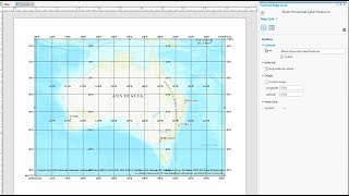
Study Area Mapping | Create Map Layout in ArcGIS
5 years ago - 17:14

Civil Engineering
How To Make Study Area Map in ArcGIS. Complete Process. #arcgis #studyareamap #civilengineering
3 years ago - 14:56

NAMONET.
ArcGIS | Creating map on ArcGIS Amharic tutorial|nastech|Title|Date| Grid| Scale|Author |NAMONET.
2 years ago - 20:53

eGIS Associates
Comparing ArcGIS Pro 2 6 and ArcMap 10 8 1
4 years ago - 33:24

GeoDelta Labs
A Complete Beginner's Guide to ArcGIS Desktop (Part 2)
4 years ago - 44:10

ArcGIS
Introducing ArcGIS Pro
8 months ago - 13:21

AP Technology
how to create shapfile in ArcGIS desktop
1 year ago - 0:16

Esri
What is GIS?
11 months ago - 8:42

eGIS Associates
ArcMap vs ArcGIS Pro - Comparing these two GIS applications from Esri
6 years ago - 34:47

Shahriar GIS School
ArcMap vs ArcGIS Pro (Course: ArcGIS vs ArcGIS Pro Level 1: Fundamental, Lecture:12) | Desktop GIS |
4 years ago - 3:45

Geonity
Prepare soil map ArcGIS ArcMap. Map layout GIS #map #tutorial #gis #arcmap #education #topography
6 months ago - 0:16

Mr Cognito
Vector vs Raster Data - GIS Explained
1 year ago - 2:35

GeoDelta Labs
Digitizing in ArcMap (and Adding Labels to the Features)
6 years ago - 14:07

Spatial Zone
What Is GIS? A Guide to Geographic Information Systems
2 years ago - 8:03
El Geógrafo
Clip #arcmap #arcgistutorial
2 years ago - 0:13

ArcGIS
Get Started with ArcGIS Online
3 years ago - 3:09

Don Boyes
Vector buffers in ArcMap
12 years ago - 5:23

GISmentor 2020
Three Ways in Georeferencing JPEG Map Images in ArcMap/ArcGIS
4 years ago - 15:24

Chris Goranson
GIS Tutorial: How to perform a spatial join in ArcMap
14 years ago - 6:06

Esri
Generative AI Prototypes in ArcGIS
9 months ago - 3:36

ArcGIS
ArcGIS Online: Mapping Basics
3 years ago - 3:32

GIS Chops
GIS Skills: Align Features in ArcGIS Pro
3 years ago - 11:34

RS & GIS
ArcGIS Pro Complete Beginner's Tutorial - ArcGIS Pro Full Course
3 years ago - 1:19:19

GeoDelta Labs
How to Georeference an Image or a Scanned Map using ArcMap
6 years ago - 17:09

Esri Canada
Migrating from ArcMap to ArcGIS Pro
4 years ago - 8:23

GeoDelta Labs
Creating a Map using ArcGIS (A step-by-step guide)
5 years ago - 31:18

GIS & RS tutorials
ArcGis Tutorial for the beginner part 1/ Add DEM Image
2 years ago - 0:27

ProGIS
Copying and pasting features ArcMap
5 years ago - 0:29

Maven Design
How to Export attribute table from ArcGIS to Excel sheet l The Easiest export
5 years ago - 2:01

Spatial Zone
Converting Labels to Annotations or Graphics in ArcGIS Pro
1 year ago - 2:27

GeoDelta Labs
Georeferencing an Image or a Scanned Map using ArcGIS Pro
2 years ago - 23:21

GIS Chops
ArcGIS Pro Editing - Start and Stop an Edit Session
3 years ago - 1:48

Don Boyes
Basic Topology in ArcMap
12 years ago - 6:03

burdGIS
Arcmap to ArcGIS Pro 01 - Installing ArcPro trial | burdGIS
7 years ago - 6:08
Arnold Kilaini
How to connect Living Atlas in ArcGIS Pro.#data #arcgispro #gis #arnold #mutegeki #kilaini #mapping
1 year ago - 0:59

Plano Area
Perbedaan antara Union, Intersect, dan Merge di ArcGIS
5 months ago - 0:58

ArcGIS
Georeferencing in ArcGIS Pro in 5 Minutes: Rubbersheeting
3 years ago - 6:12

Steve Aldrich
ArcGIS Pro - Pan and Zoom in Map and Layout Views
4 years ago - 2:18

GIS & RS Solution
A Complete Beginner's Guide to ArcGIS Pro: Part 1
3 years ago - 9:39

Steve Aldrich
ArcGIS Pro - Connect to a Folder and Add Data
4 years ago - 3:49
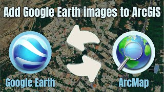
RS & GIS
How to add the latest Google Earth images to ArcGIS directly
1 year ago - 3:43

Civil Tycoon
how to import excel data into arcgis quickly
5 years ago - 1:43

Made 4 Geek
Arcgis : Merge the raster datasets /fusionner raster arcgis /Mosaic raster dataset ArcGIS
9 years ago - 5:10

Obaidur Rahman
Master the Digitizing in 15 Minutes | ArcGIS In-Depth Tutorial
5 years ago - 16:23

Esri
3 New Cartography Features in ArcGIS Pro
1 year ago - 2:12

ProGIS
Merge two layers in one ArcMap
5 years ago - 1:03
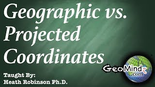
GeoMindz.com
"Geographic Coordinate Systems" and "Projected Coordinate Systems" in ArcGIS and ArcMap
7 years ago - 8:57

ProGIS
Remove decimal places from coordinates in grid ArcMap
4 years ago - 0:42

Timothy Spier
Georeferencing an Image in ArcGIS Pro
5 years ago - 14:15

GIS & RS Solution
How to add directly Google Maps/Satellite Map/Google Earth in ArcGIS
1 year ago - 5:24

GeolóGIS
🗺️ Extrae Datos RASTER con Máscara SHAPEFILE en ArcMap 10.8 🌍 #ArcMap #Geoprocesamiento #SIG #arcgis
1 year ago - 0:16

Dan GIS Spatial Lab
How to Mosaic or Merge Satellite images in ArcGIS or ArcMap
3 years ago - 6:44

GIS Chops
GIS Skills: ArcGIS Pro - the Move Tool
4 years ago - 9:00

RS & GIS
ArcGIS Desktop for Beginners: Master GIS Mapping & Analysis in One Course!
1 year ago - 51:59

Dr. Jayanta Das
How to add PDF files and do georeferencing in ArcMap?
4 years ago - 6:49

ArcTutorials Videos
How to control Labels in Arc GIS software? #arcgis #gis #esri #arcgistutorial
3 years ago - 1:57
ArcGIS
Work with a grid in ArcGIS Pro
7 years ago - 2:00

Karl Olsen
ArcGIS 10 - ArcMap - Saving Data
14 years ago - 1:19

ArcGIS
Bookmark Map Series in ArcGIS Pro | Tutorial
1 year ago - 1:00

Spatial Monkey
How to create an ArcGIS Pro Python Toolbox with example code
1 year ago - 5:44

Ahsan Khan
Exporting from Arc GIS to Google Earth Pro
3 years ago - 1:36
ProGIS
Remove decimal places from coordinates in grid ArcMap
4 years ago - 0:42

Don Boyes
Adding Landsat 8 satellite images to ArcMap
5 years ago - 4:08

GIS-RS Automation
#GIS How to Merge Multiple Polygons features into single polygon in ArcMap 10.5
3 years ago - 2:23

RaxsCorp
Buffer ArcGIS - ArcGIS Buffer Analysis - Arcmap Tutorial For Beginners
5 years ago - 3:13

Spatial Zone
20 ArcGIS Pro Tips & Tricks
2 years ago - 11:44

Geo Magazine
ArcMap Convert Polylines to Polygons, Two easy methods
6 years ago - 3:34

Steve Aldrich
ArcGIS Pro - Adding a Field to an Attribute Table
4 years ago - 3:05

GeoDelta Labs
Creating Features by Digitizing in ArcGIS Pro
2 years ago - 20:49

GeolóGIS
Cómo etiquetar curvas de nivel inteligente en arcmap #arcmap #curvas #nivel #etiquetar #cartografía
1 year ago - 0:16

ArcGIS
Navigate maps and scenes in ArcGIS Pro
2 years ago - 7:44

gis2cad
convert shapefile to geodatabase in ArcGIS
8 years ago - 2:10

GIS Solutions
ArcGIS Pro tutorial - How to import and open a MXD file in ArcGIS Pro
3 years ago - 1:15

ArcGIS
Get to Know ArcGIS Field Maps
4 years ago - 3:26

Dr. Jayanta Das
How to draw parallel lines in ArcMap II ArcMap Editor II Copy Parallel II Arc GIS Basics
2 years ago - 2:13

Ram Khilawan
Selected Feature Count in ArcGIS #FeatureCount #GISAnalysis #ArcGISTips #sorts #viral #trending
2 weeks ago - 0:19

Hem Raj Awasthi
ArcGIS Tutorial 8 : Divide a polygon into equal parts using arcgis
5 years ago - 7:05

ArcGIS Shorts
How to Convert Features Vertices To Point in ArcGIS 10.8 #qgis3 #gis #map #arcmap #arcgispro
2 years ago - 1:00
Plano Area
Perbedaan ArcGIS dan ArcMap
5 months ago - 1:02

The GIS Hub
Top 10 GIS Software Applications In 2022 || Geographic Information System || #geoid #GIS
3 years ago - 1:45

Timothy Spier
Fix license server problem in ArcMap
8 years ago - 1:33
Maven Design
Snapping Tool in ArcMap ll How to add snap when editing in ArcMap
3 years ago - 2:48

Spatial Zone
How To Create NDVI Maps in ArcGIS Pro
2 years ago - 4:09

ProGIS
Change the Size of the Map Page. ArcMap
3 years ago - 1:03

Elite & Afana
How to Georeference a Google earth image in ArcMap
3 years ago - 10:32